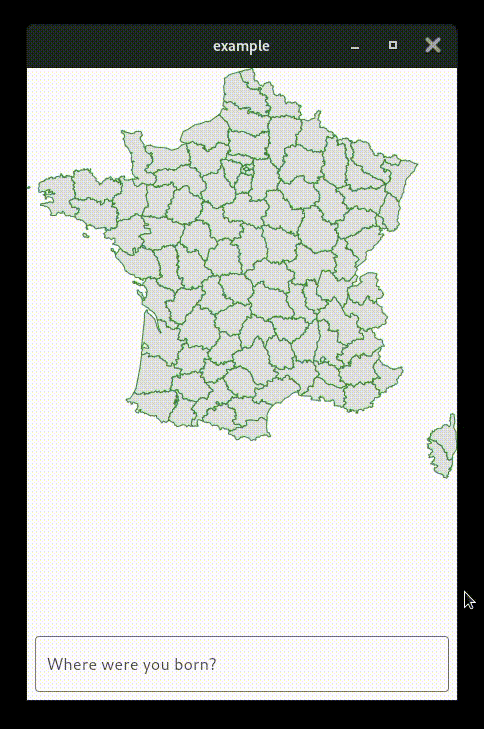
Interactive country map
The purpose of this package is to draw an interactive map of a country or region where you can select a region.
It can be used to plot data.
How to install
flutter pub add interactive_country_map
Or go here: pub.dev
Demo
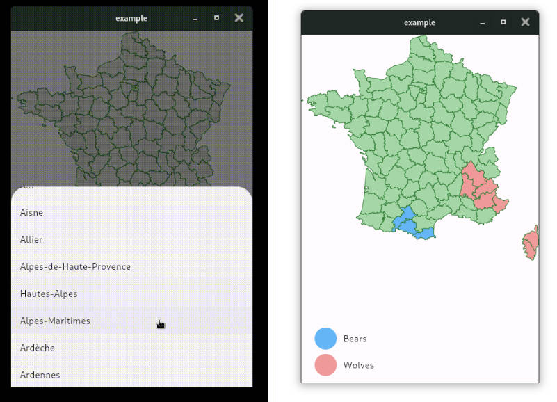
| Interaction | Chart |
|---|---|
 |
 |
How does it work?
The SVG maps are defined by several <path> tags. Because it's XML, we can define an id for each of them. The IDs are unique and defined by the ISO_3166-2.
When a country is selected, its id is returned.
Docs
Interactive map
Use the InteractiveMap in your code to add an interactive map. Then, choose among the MapEntity enum the map you need.
You can customize the theme of your map using InteractiveMapTheme.
The onCountryChanged will receive the code of the selected country/region. All the codes are defined by the ISO_3166-2.
The library is only returning country codes. It's your role to understand them and adapt your own widgets.
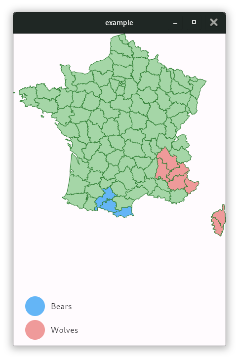
Color mapping
You might want to use different colors for your regions. For instance, all the countries starting with A will be in blue and the ones starting with B will be in red.
Add in your interactive map theme the following code:
mappingCode: {
    ...MappingHelper.sameColor(
    Colors.green.shade300,
    [
        "FR-A",
        "FR-B",
        "FR-C",
        "FR-D",
        "FR-E",
    ],
    )
},
The mappingCode accepts a Map<String, Color> when the string is the region code.
MappingHelper.sameColor is a helper to build your dictionary. It will map a list to the specified color.
Markers
You have the choice between 2 types of markers:
Marker: use the Cartesian coordinates to place the markerGeoMarker(TODO): use the lat/long to place the marker at the correct position on the map
Then, you use a MarkerGroup to gather the markers and give them properties:
MarkerGroup(
    borderColor: Colors.pink.shade600,
    backgroundColor: Colors.pink.shade300,
    markers: [
        Marker(x: 30, y: 40),
        GeoMarker(long: 2.294481, lat: 48.858370),
        Marker(x: 250, y: 340),
    ],
),
Usage Notice
This package relies on resources provided by MapSVG, which is subject to the *Creative Commons Attribution 4.0 International LicenseI (CC BY 4.0 Deed). This means that when using this package, you must adhere to the terms of the CC BY 4.0 license for any MapSVG resources utilized.
Please refer to the CC BY 4.0 Deed for more details on how to appropriately attribute MapSVG. Failure to comply with the license terms may result in legal consequences.
Additional information
Download maps on this website: Maps
Some maps are missing and I haven't found them yet. Feel free to open an issue if you have the SVG for a country or special subregion.